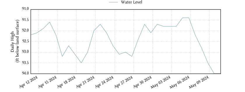
State Well Number 6837203 is 92.70 feet below land surface on 2024-04-17
Well Information **
All data are provisional and subject to revision. The Texas Water Development Board (TWDB) specifically disclaims any and all liability for any claims or damages that may result from providing these data. For additional information, including water level and water quality data, search the TWDB Groundwater Database (GWDB).
| County | Bexar |
| State Well Number | 6837203 |
| Status | Active |
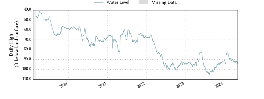
| Period of Record | 2019-01-31 to 2024-04-17 |
| Entity/Cooperator | Edwards Aquifer Authority |
| Cooperator ID | J17 |
| Aquifer | Edwards (Balcones Fault Zone) |
| Formation | Edwards and Associated Limestones - (Balcones Fault Zone Aquifer) |
| Aquifer Type | Confined |
| Well Depth (ft below land surface) | 874.00 |
| Instrument | Unknown |
| Transmission | Cellular |
| Groundwater Conservation District | Edwards Aquifer Authority |
| Groundwater Management Area | 10 |
| Estimated Land Elevation (ft above sea level) | 731 |
| Location (lat, long) | (29.4791670, -98.4325000) |
| Download Data | csv json txt |
Data Summary
| Date |
Daily High Water Level (ft below land surface) |
Height Below Most Recent (ft) |
|
|---|---|---|---|
| Most recent | 2024-04-17 | 92.70 | - n.a. - |
| 1 day prior | 2024-04-16 | 93.20 | 0.50 |
| 2 days prior | 2024-04-15 | 92.20 | -0.50 |
| 1 week prior | 2024-04-10 | 92.30 | -0.40 |
| 1 month prior | 2024-03-17 | 90.30 | -2.40 |
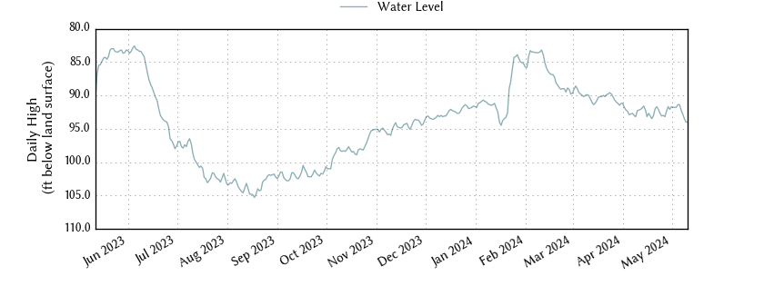
| 3 months prior | 2024-01-17 | 94.50 | 1.80 |
| 6 months prior | 2023-10-17 | 98.50 | 5.80 |
| 1 year prior | 2023-04-17 | 96.00 | 3.30 |
| oldest | 2019-01-31 | 44.70 | -48.00 |
footnotes
**
Water level data are maintained by the Edwards Aquifer Authority (EAA). Original data reported in feet above mean sea level, and transcribed by TWDB to feet below land surface using the estimated land surface elevation provided by the EAA.