Drought in Texas
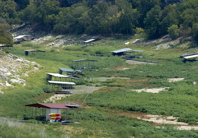
Texas is no stranger to drought. The seven-year drought of record in the 1950s was a turning point in Texas history that led to the formation of the Texas Water Development Board. Since then, Texas has faced several droughts, including its most recent and severe drought, which began in the fall of 2010 and lasted through winter 2014/2015. The National Oceanic and Atmospheric Administration's (NOAA) Integrated Drought Information System (NIDIS) and Modeling, Analysis, Predictions and Projections program (MAPP) developed a Story Map. This website brings together relevant resources, links, data, and analyses to provide updated information on drought in Texas.
TWDB and Drought
The Texas Water Development Board (TWDB) serves on the Texas Drought Preparedness Council and the Emergency Drinking Water Task Force. The Task Force is responsible for helping water suppliers find solutions to water supply shortages. The Council is charged with supporting drought management efforts in the state and with conducting drought monitoring, assessment, preparedness, mitigation, and assistance. To serve this purpose, the Council prepares monthly drought situation reports on the status of drought conditions in the state and delivers these reports to state leadership. The latest monthly report can be viewed at the Council's home page.
The TWDB also provides financial assistance to entities across Texas in the form of both grants and loans. Assistance can be used for planning, acquisition, design, and construction of water-related infrastructure as well as other water quality improvements. Financial Assistance Project Teams for each of six geographic regions are designed to assist entities with the application process.
TWDB staff prepare monthly Texas Water Conditions reports. These reports document storage in the state's reservoirs as well as groundwater levels in the state's aquifers. In addition, TWDB issues a weekly water report and maintains information on reservoir storage and groundwater well levels across the state.
The TWDB is also a cooperator with the U.S. Geological Survey in monitoring real-time stream flows across the state.
The TWDB, in coordination with regional water planning groups across the state, develops a state water plan that plans for a repeat of the drought of record. The latest state water plan and planning efforts are available on the Water Resources Planning Information section of the TWDB website.
In addition to this website the TWDB publishes a PDF summary of TWDB's Drought Resources.
Online Drought Resources
Extensive drought-related resources are also available online. The following categories include commonly referenced drought-related websites.
What is Drought?
- Drought is a period of abnormally dry weather sufficiently long enough to cause a serious hydrological imbalance. (source: American Meteorological Society)
-
Types of drought:
- Agricultural drought - when a shortage of rainfall during the growing season results in crop damage.
- Hydrological drought - when a shortage of precipitation affects water supplies.
- Drought definitions vary by context and impact. For more drought definitions, see:
- Definition according to the National Centers for Environmental Information
- Definition according to the National Drought Mitigation Center
Drought Status
- North American Drought Monitor: We use this map to get a broader perspective on the drought, especially in those areas outside of Texas that impact water resources in Texas, namely southern Colorado and northern New Mexico (flows in the Rio Grande and levels in Elephant Butte Reservoir that impact water supplies in the El Paso area), eastern New Mexico (impacts to flows in the Canadian and Pecos rivers), and northern Mexico south of Big Bend (impacts to inflows to the Rio Grande). Note that this map reflects rainfall and soil moisture deficits and does not necessarily indicate water-supply status. Also note that the D0-Abnormally Dry category is not technically drought and represents a transition into or out of drought conditions.
- Texas Drought Monitor: We use this map to focus in on Texas. The Texas Drought Monitor also has historical data for Texas in tabular format. Note that this map reflects rainfall and soil moisture deficits and does not necessarily indicate water-supply status. Also note that the D0-Abnormally Dry category is not technically drought and represents a transition into or out of drought conditions.
- Texas drought status over time: We use the graph at the bottom of this page to assess how drought conditions have changed over time.
- Drought in Your Backyard: Type in your zip code and find out your Drought Monitor intensity. Fun for the whole family!
- Drought webinars: This site contains links to past drought-related webinars from the NIDIS Southern Plains Drought Early Warning System.
Drought Impacts
- Rainfall (Precipitation): We use this site to map accumulated rainfall over a specific time period. There are options to map observed rainfall, average rainfall, departure from average rainfall, and percent of average rainfall for the time period specified.
- Soil moisture: We use this site, particularly the Monthly Percentile, to assess soil moisture conditions across the state. Soil moisture affects crops as well as runoff into rivers and reservoirs.
- Streamflow: We use this site to see how drought might be affecting streamflow across the state. We chose the gauges shown at this site to reflect relatively undeveloped areas not impacted by reservoir releases or wastewater return flows. This gives us a sense of natural runoff into rivers and streams that might be expected above a reservoir. We consider flow less than 30 percent to be low. More detailed (and less restrictive) information on streamflow is available in USGS' WaterWatch website.
- Priority calls on surface water: We use this site to see the status of priority calls on surface water. Texas manages surface water through prior appropriations. When a senior right holder doesn't have enough water, he or she can make a priority call to the Texas Commission on Environmental Quality to require more junior, upstream water right holders to stop taking water from the river.
- Reservoir storage: We use this site to see how drought might be affecting reservoir levels across the state, including Elephant Butte Reservoir, which is located in New Mexico but is an important source of water to the El Paso area.
- Groundwater levels: We use this site to see how drought might be affecting groundwater levels across the state. Note that water levels in many aquifers decline every year regardless of drought but may decline faster during droughts. Information on a well important for the management of the San Antonio Segment of the Edwards {Balcones Fault Zone} Aquifer, J-17, can be found in Water Data for Texas, Edwards Aquifer Authority, San Antonio Water System websites.
- Public Water Systems: We use this site to see how many and which public water supply systems have been impacted by drought through the activation of their drought contingency plans. The Texas Commission on Environmental Quality provides a list of the affected communities and which ones have reported less than 180, 90, and 45 days of water.
- Vegetation Drought Response Index: We use this site to see how vegetation in the state is responding to the drought.
- County burn bans: We use this site to see which counties have instituted burn bans.
- Wildfires: We use this site to see how many wildfires have occurred in Texas and the current status of wildfires.
- Drought impact reporter: We use this site to find media and other reports about drought impacts.
- Governer's Drought Disaster Declaration: Based on recommendations from representatives of the Drought Preparedness Council, the Governor makes a drought disaster proclamation that is delivered to county judges who in turn share the proclamation with public water supply systems. Notified systems must then implement their water conservation plans and drought contingency plans as applicable.
Drought Outlook
- One-Month Outlook: We use this site to see a projection by the Climate Prediction Center on temperature and rainfall over the next month. There are other projections that extend out as far as 12.5 months available at this site (although we don't necessarily believe anything beyond three months).
- U.S. Monthly Drought Outlook: We use this site to see a projection by the Climate Prediction Center on expected drought conditions one month out.
- Projected Drought: We use this tool to assess the severity of drought conditions in the upcoming month.
- Worst Case Drought: We use this tool to assess the worst drought that could occur over a given time span (such as one month or six months) if no rain falls through the end of that period. We also use the tool to assess how much rainfall is needed to come out of such a worst case drought and the odds of that happening over the period of interest.
- U.S. Seasonal Drought Outlook (three-month outlook): We use this site to see a projection by the Climate Prediction Center on expected drought conditions three months out.
- Atlantic Hurricane Outlook: We use this site to see what the outlook is for the hurricane season.
- Current Tropical Weather: We use this site to see what the outlook is for the hurricane season.
- El Niño/Southern Oscillation Outlook: We use this site to assess the likelihood of El Niño (cooler and wetter Texas winters but suppression of tropical systems) or La Niña (warmer and dryer Texas winters) conditions. Figure 6 in the outlook shows a spaghetti chart of different statistical and dynamical model projections as well as associated ensemble means results.
- Pacific Decadal Oscillation: We use this site to see the status of the Pacific Decadal Oscillation. The Pacific Decadal Oscillation refers to long-term fluctuations in sea surface temperatures between the western north Pacific Ocean and the Pacific coast of North America. A PDO “negative” or “cool phase”, when warmer than normal sea surface temperatures prevail in the western north Pacific Ocean and cooler than normal sea surface temperatures prevail off the Pacific coast of North America, is generally associated with higher temperatures and lower rainfall in the summer over Texas. A PDO “positive” or “warm phase”, when cooler than normal temperatures prevail in the western north Pacific and warmer than normal sea surface temperatures prevail off the Pacific coast, is generally associated with lower temperatures and higher rainfall in the summer over Texas.
- Atlantic Multidecadal Oscillation: We use this site to see the status of the Atlantic Multidecadal Oscillation. The Atlantic Multidecadal Oscillation refers to long-term fluctuations in sea surface temperatures in the northern Atlantic Ocean. Warmer than normal sea surface temperatures in the northern Atlantic Ocean are generally associated with higher temperatures and lower rainfall in the summer over Texas as well as more tropical systems turning into hurricanes in the Atlantic basin but fewer tropical systems moving into the Gulf of Mexico and making landfall over Texas.
- Amount of Rainfall Needed to Come Out of Drought: We use this site to determine how much rainfall is needed to come out of drought and the odds of that happening over different time periods.
- Wildland Fire Outlook: We use this site to determine where wildfires might be an issue in the near future.
Drought Response
- Texas Drought Preparedness Council: TWDB is a member of this Council, which is charged with preparing the state's Drought Preparedness Plan and situation reports that are delivered to state leadership. The Council also coordinates the state response to drought.
- Texas Commission on Environmental Quality: The Commission provides hands-on assistance to communities responding to drought.
- Texas Water Development Board: The Board not only provides information on drought and water resources but can also provide financial assistance to help communities respond to drought.
- Texas Department of Agriculture: The Department may have grants to assist rural communities struggling with drought.
- Texas Water Infrastructure Coordination Committee: The Committee is made up of state and federal funding agencies, technical assistance providers, and other members of the water community and works with entities across Texas to identify and develop solutions to water challenges brought on by drought.
- Tool for Planning Water Supply Response in Drought Emergencies: The tool is offered to support water resource and utility professionals with the challenge of providing water to communities under the influence of severe drought. The objective of the tool is to assist in planning for water shortages by familiarizing users with alternative sources, treatment processes, distribution options, short term equipment solutions for treatment, and the regulatory process as it relates to emergency drought situations.
- Agricultural Drought Task Force: A task force focused on drought and agriculture in Texas.
- State of Texas Drought Annex: The State of Texas Drought Annex is prepared by the Drought Preparedness Council and serves as the drought-focused component of the State of Texas Emergency Management Plan.
Other
- Monthly Texas Water Conditions Report
- National Drought Mitigation Center
- Office of the State Climatologist
- U.S. Drought Portal
- U.S. Drought Portal Data Gallery
- Water Conservation Advisory Council
- Weekly Texas Drought Reports
- Weather Underground
- National Weather Service Precipitation Map
- Community Collaborative Rain, Hail & Snow Network
What You Can Do To Help
- How to Prepare for Droughts
- Earth-Kind® Drought Preparedness
- TWDB Kids
- TWDB Water IQ Program
- Avoid wasting water at home, in the lawn and garden and on the farm or ranch
For more information about the drought and drought assistance, please contact TWDB staff.