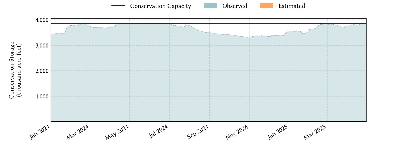
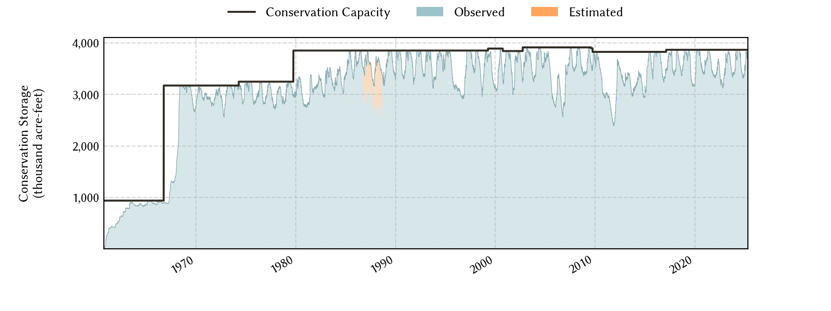
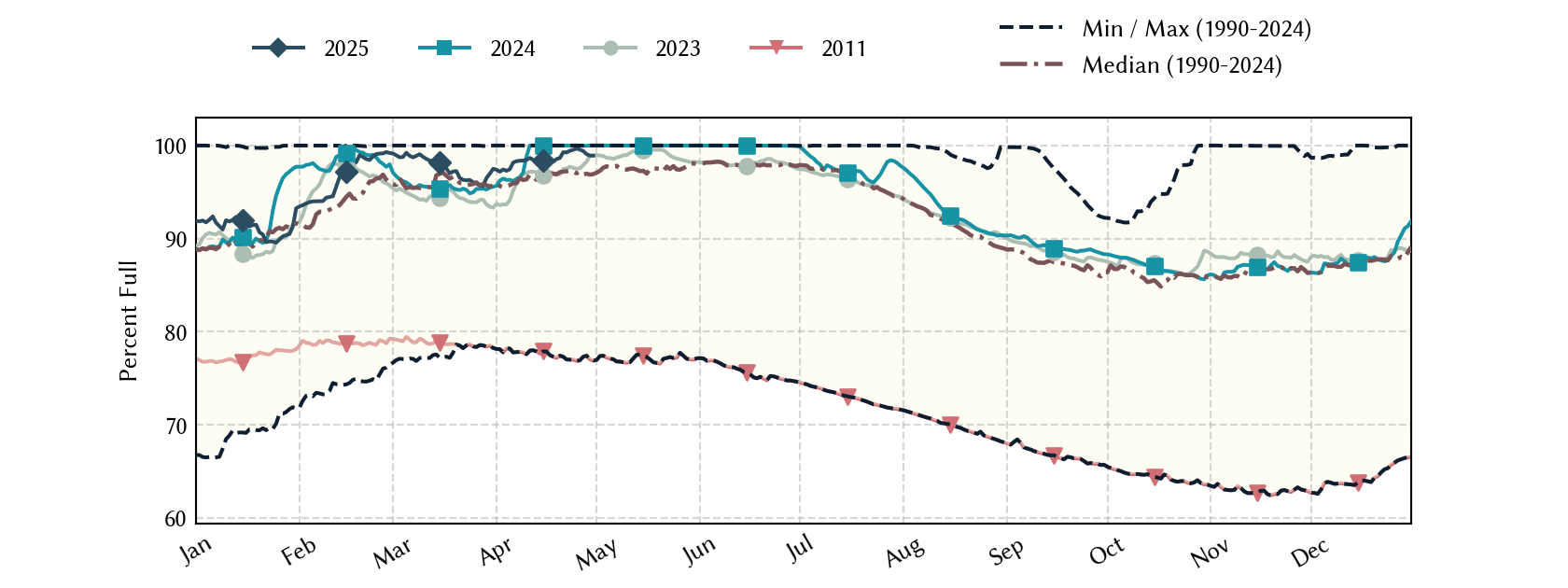
Sabine River Basin Reservoirs: Monitored Water Supply Reservoirs are 93.2% full on 2026-07-30
Historical Data
| Date | Percent Full |
Reservoir Storage (acre-ft) |
Conservation Storage (acre-ft) |
Conservation Capacity (acre-ft) |
|
|---|---|---|---|---|---|
| Today | 2026-07-30 | 93.2 | 5,712,553 | 3,605,543 | 3,868,328 |
| Yesterday | 2026-07-29 | 93.3 | 5,719,321 | 3,609,817 | 3,868,328 |
| 2 days ago | 2026-07-28 | 93.5 | 5,729,461 | 3,615,802 | 3,868,328 |
| 1 week ago | 2026-07-23 | 94.2 | 5,776,850 | 3,645,226 | 3,868,328 |
| 1 month ago | 2026-06-30 | 95.8 | 5,882,822 | 3,707,110 | 3,868,328 |
| 3 months ago | 2026-04-30 | 92.0 | 5,606,478 | 3,560,222 | 3,868,328 |
| 6 months ago | 2026-01-30 | 86.8 | 5,283,288 | 3,359,088 | 3,868,328 |
| 1 year ago | 2025-07-30 | 96.4 | 5,872,438 | 3,727,274 | 3,868,328 |
*
Percent Full is based on Conservation Storage and Conservation Capacity and doesn't account for storage in flood pool.
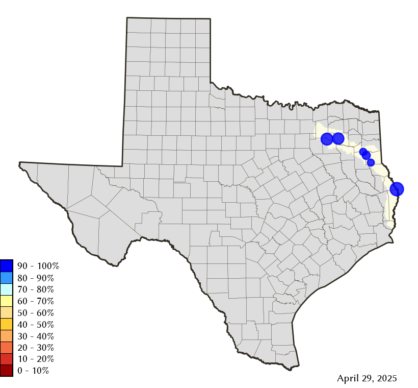
Area Map
Reservoir Storage
| Reservoir | Type | Percent Full |
Water Level (ft) |
Height Above Conservation Pool (ft) |
Reservoir Storage (acre-ft) |
Conservation Storage (acre-ft) |
Conservation Capacity (acre-ft) |
Surface Area (acres) |
|---|---|---|---|---|---|---|---|---|
| Cherokee |

|
97.3 | 279.60 | -0.40 | 43,389 | 39,007 | 40,094 | 3,612 |
| Fork |
|
88.1 | 400.18 | -2.82 | 565,316 | 533,873 | 606,088 | 24,327 |
| Martin |
|
92.5 | 304.83 | -1.17 | 70,054 | 70,054 | 75,726 | 4,741 |
| Murvaul |
|
96.9 | 264.95 | -0.35 | 37,091 | 37,091 | 38,285 | 3,391 |
| Tawakoni |
|
98.5 | 437.14 | -0.36 | 858,449 | 858,441 | 871,685 | 36,576 |
| Toledo Bend 1 |
|
92.4 | 169.92 | -2.08 | 4,138,254 | 2,067,077 | 2,236,450 | 172,450 |
footnotes
1
Toledo Bend Reservoir straddles the border of Texas and Louisiana, Texas has rights to 50% of Toledo Bend Reservoir's total conservation capacity. Percent full, conservation storage and conservation capacity are based on the Texas share.