Lavaca Planning Region Reservoirs: Monitored Water Supply Reservoirs are 85.8% full on 2026-09-17
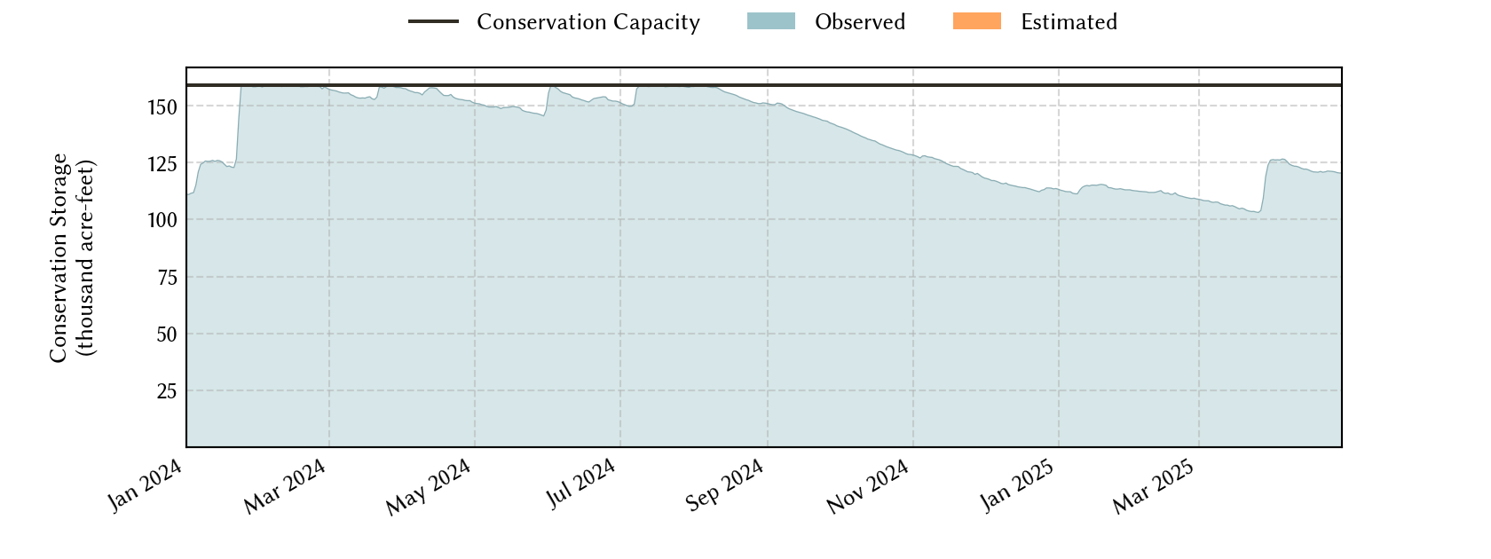
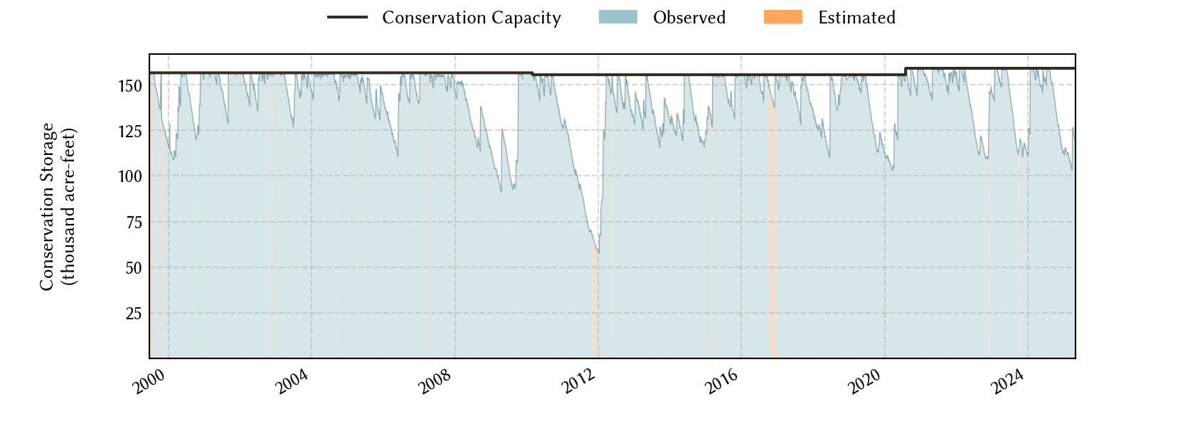
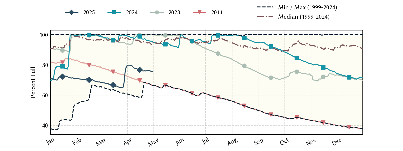
Historical Data
| Date | Percent Full |
Reservoir Storage (acre-ft) |
Conservation Storage (acre-ft) |
Conservation Capacity (acre-ft) |
|
|---|---|---|---|---|---|
| Today | 2026-09-17 | 85.8 | 141,636 | 136,423 | 158,975 |
| Yesterday | 2026-09-16 | 85.3 | 140,800 | 135,587 | 158,975 |
| 2 days ago | 2026-09-15 | 85.5 | 141,079 | 135,866 | 158,975 |
| 1 week ago | 2026-09-10 | 86.7 | 143,039 | 137,826 | 158,975 |
| 1 month ago | 2026-08-17 | 92.8 | 152,739 | 147,526 | 158,975 |
| 3 months ago | 2026-06-17 | 99.8 | 163,878 | 158,665 | 158,975 |
| 6 months ago | 2026-03-17 | 53.8 | 90,803 | 85,590 | 158,975 |
| 1 year ago | 2025-09-17 | 83.7 | 138,315 | 133,102 | 158,975 |
*
Percent Full is based on Conservation Storage and Conservation Capacity and doesn't account for storage in flood pool.
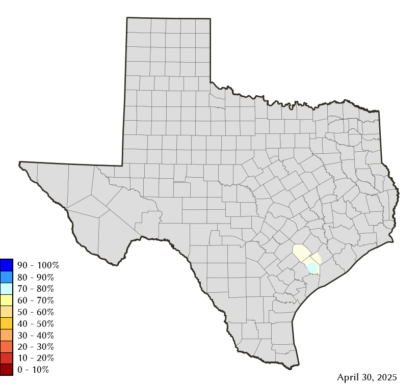
Area Map
Reservoir Storage
| Reservoir | Type | Percent Full |
Water Level (ft) |
Height Above Conservation Pool (ft) |
Reservoir Storage (acre-ft) |
Conservation Storage (acre-ft) |
Conservation Capacity (acre-ft) |
Surface Area (acres) |
|---|---|---|---|---|---|---|---|---|
| Texana |

|
85.8 | 41.70 | -2.30 | 141,636 | 136,423 | 158,975 | 9,313 |