Cypress River Basin Reservoirs: Monitored Water Supply Reservoirs are 93.8% full on 2026-07-29
Historical Data
| Date | Percent Full |
Reservoir Storage (acre-ft) |
Conservation Storage (acre-ft) |
Conservation Capacity (acre-ft) |
|
|---|---|---|---|---|---|
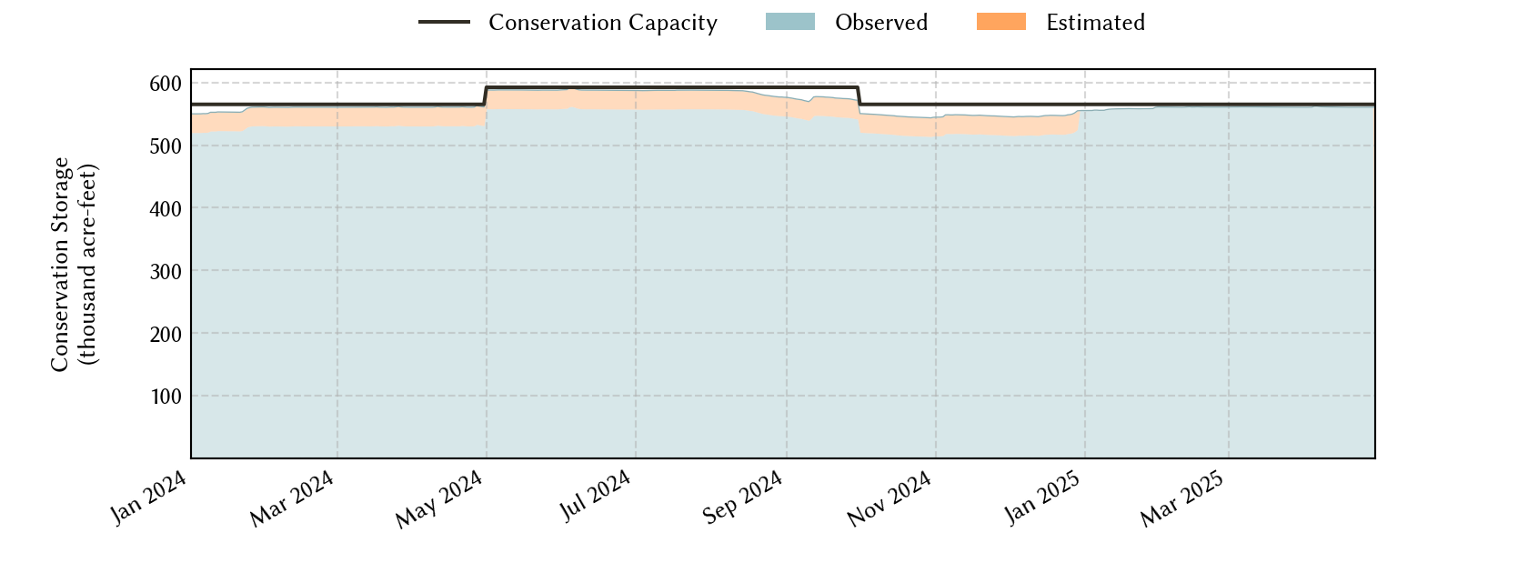
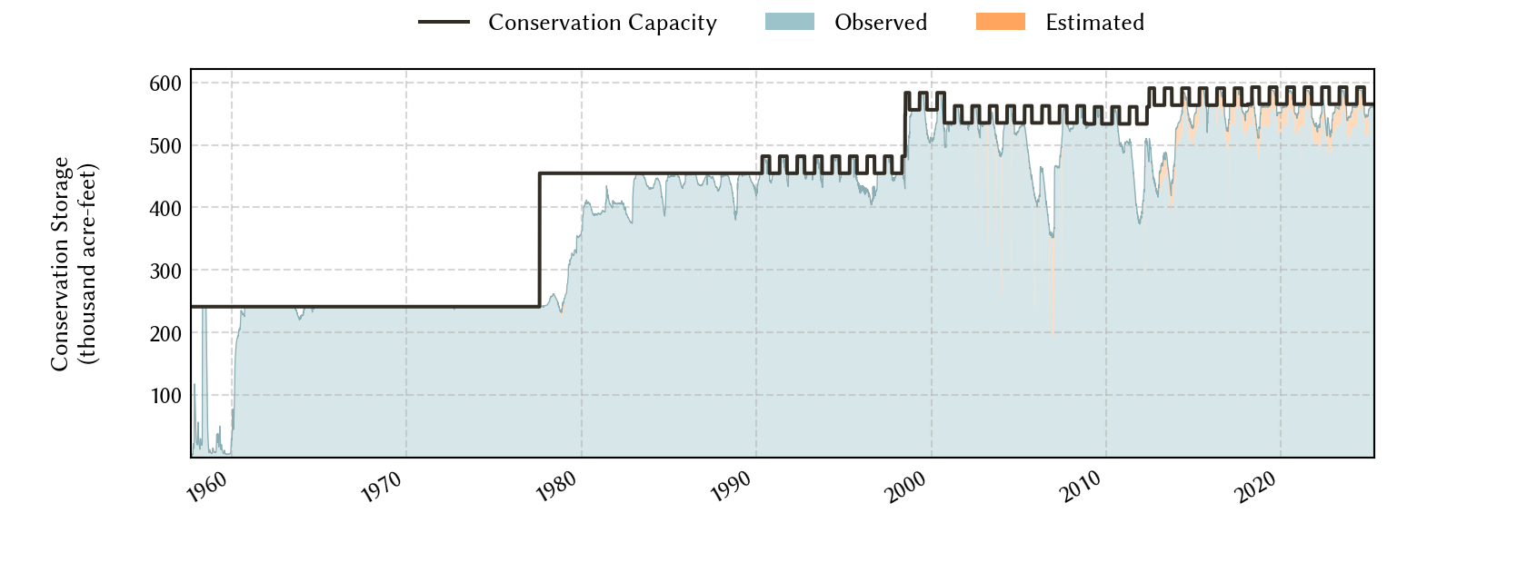
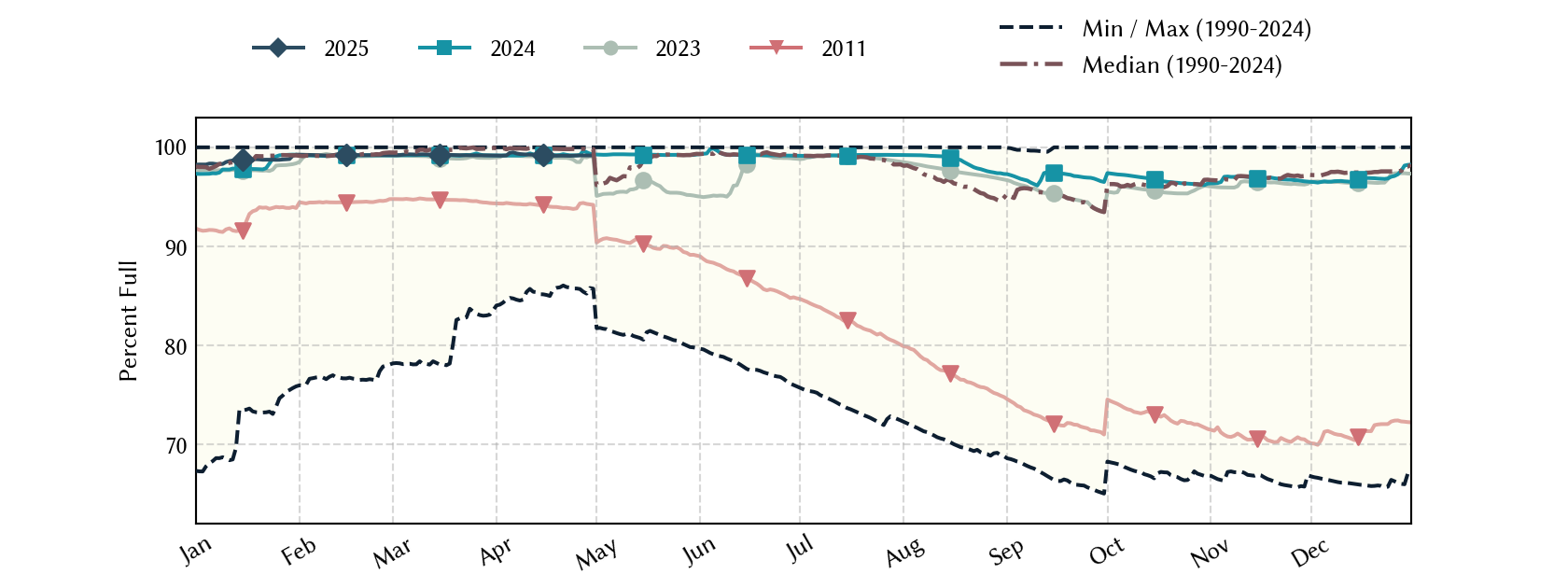
| Today | 2026-07-29 | 93.8 | 668,843 | 555,748 | 592,377 |
| Yesterday | 2026-07-28 | 93.9 | 669,416 | 556,080 | 592,377 |
| 2 days ago | 2026-07-27 | 94.0 | 670,991 | 556,934 | 592,377 |
| 1 week ago | 2026-07-22 | 94.7 | 678,986 | 561,093 | 592,377 |
| 1 month ago | 2026-06-29 | 94.9 | 693,404 | 562,252 | 592,377 |
| 3 months ago | 2026-04-29 | 97.3 | 670,465 | 549,673 | 565,174 |
| 6 months ago | 2026-01-29 | 96.0 | 663,136 | 542,746 | 565,174 |
| 1 year ago | 2025-07-29 | 98.5 | 701,861 | 583,408 | 592,377 |
*
Percent Full is based on Conservation Storage and Conservation Capacity and doesn't account for storage in flood pool.
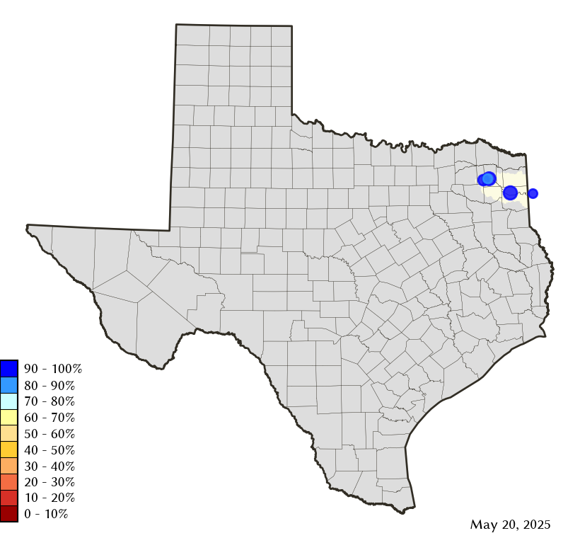
Area Map
Reservoir Storage
| Reservoir | Type | Percent Full |
Water Level (ft) |
Height Above Conservation Pool (ft) |
Reservoir Storage (acre-ft) |
Conservation Storage (acre-ft) |
Conservation Capacity (acre-ft) |
Surface Area (acres) |
|---|---|---|---|---|---|---|---|---|
| Bob Sandlin |

|
95.0 | 336.41 | -1.09 | 193,576 | 182,845 | 192,417 | 8,675 |
| Caddo 1 |
|
100.0 | 168.67 | 0.17 | 132,262 | 29,898 | 29,898 | 27,111 |
| Cypress Springs |
|
96.4 | 377.24 | -0.76 | 64,320 | 64,320 | 66,756 | 3,177 |
| Lake O' the Pines |

|
93.5 | 229.04 | -0.96 | 250,983 | 250,983 | 268,566 | - n.a. - |
| Monticello |
|
79.7 | 336.24 | -3.76 | 27,702 | 27,702 | 34,740 | 1,661 |
footnotes
1
Caddo Lake straddles the border of Texas and Louisiana, Texas has rights to 50% of Lake Caddo's total conservation capacity. Percent full, conservation storage and conservation capacity are based on the Texas share.