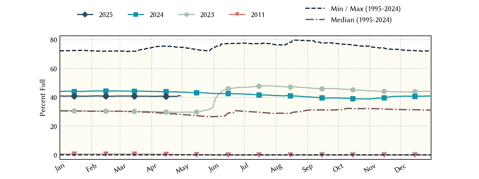
Lake Meredith: 44.7% full as of 2026-10-25
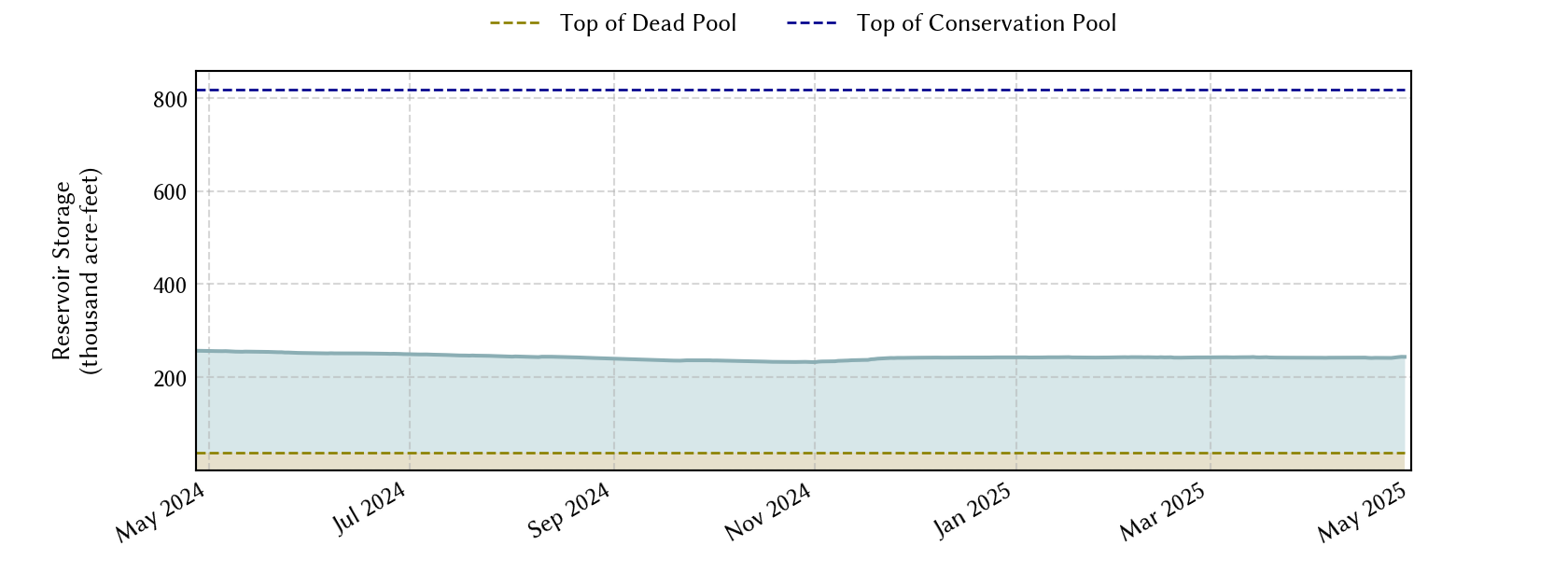
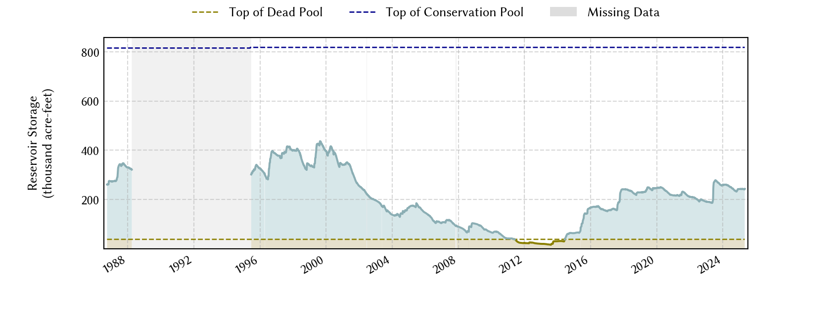
Lake Meredith is governed by the Canadian River Compact. The States of New Mexico, Texas and Oklahoma are all parties to the compact created by agreement of the three states and the federal government in 1950. According to the compact, New Mexico can hold 200,000 acre-feet in Ute Lake before it has to release water to Texas. Texas also can only hold 500,000 acre-feet in Lake Meredith before it has to release water for Oklahoma.
Historical Data
| Date | Percent Full |
Mean Water Level (ft) |
Reservoir Storage (acre-ft) |
Conservation Storage (acre-ft) |
Conservation Capacity (acre-ft) |
Surface Area (acres) |
|
|---|---|---|---|---|---|---|---|
| Today | 2026-10-25 | 44.7 | 2,891.40 | 261,710 | 223,296 | 500,000 | 8,657 |
| Yesterday | 2026-10-24 | 44.7 | 2,891.40 | 261,710 | 223,296 | 500,000 | 8,657 |
| 2 days ago | 2026-10-23 | 44.7 | 2,891.41 | 261,796 | 223,382 | 500,000 | 8,658 |
| 1 week ago | 2026-10-18 | 44.6 | 2,891.38 | 261,537 | 223,123 | 500,000 | 8,655 |
| 1 month ago | 2026-09-25 | 40.6 | 2,888.86 | 241,243 | 202,829 | 500,000 | 7,337 |
| 3 months ago | 2026-07-25 | 43.3 | 2,890.59 | 254,730 | 216,316 | 500,000 | 8,580 |
| 6 months ago | 2026-04-25 | 45.0 | 2,891.62 | 263,618 | 225,204 | 500,000 | 8,679 |
| 1 year ago | 2025-10-25 | 47.7 | 2,893.13 | 276,833 | 238,419 | 500,000 | 8,823 |
Percent Full is based on Conservation Storage and Conservation Capacity and doesn't account for storage in flood pool.
Values above, including today's are averaged conditions. For near real-time instantaneous water level, see table below or the interactive map viewer.
Most Recent Instantaneous Water Level
| Date/time |
Water Level (ft) |
Conservation Pool Elevation (ft) |
Height Above Conservation Pool (ft) |
|
|---|---|---|---|---|
| Most recent | 2026-10-25 16:30 | 2,891.51 | 2,936.50 | -44.99 |
| 1 hour prior | 2026-10-25 15:30 | 2,891.52 | 2,936.50 | -44.98 |
| 2 hours prior | 2026-10-25 14:30 | 2,891.50 | 2,936.50 | -45.00 |
| 6 hours prior | 2026-10-25 10:30 | 2,891.42 | 2,936.50 | -45.08 |
| 12 hours prior | 2026-10-25 04:30 | 2,891.36 | 2,936.50 | -45.14 |
| 24 hours prior | 2026-10-24 16:30 | 2,891.41 | 2,936.50 | -45.09 |
| 48 hours prior | 2026-10-23 16:30 | 2,891.41 | 2,936.50 | -45.09 |
Data is provisional and subject to revision.
Additional Information
| Impoundment date | 1965-01-01 |
| Vertical datum | NGVD29 |
| Dead pool elevation | 2,850.00 ft above NGVD29 |
| Service spillway crest elevation | 2,965.00 ft above NGVD29 |
| Maximum design elevation | 3,004.90 ft above NGVD29 |
| Top of dam elevation | 3,011.00 ft above NGVD29 |
| Conservation pool elevation | 2,936.50 ft above NGVD29 |
| Data download (CSV) | period of record, last one year, last 30 days |
| Data Source | USGS:07227900 |
| USGS Monitoring Location | USGS:07227900 |
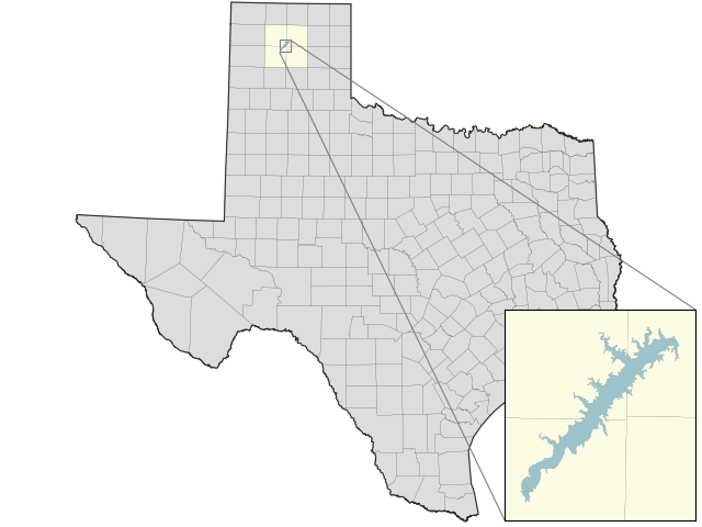
Lake Location